
5 JAPANESE MOUNTAIN TRAILS WORTH VISITING
Yoshida trail to the sacred Mount Fuji
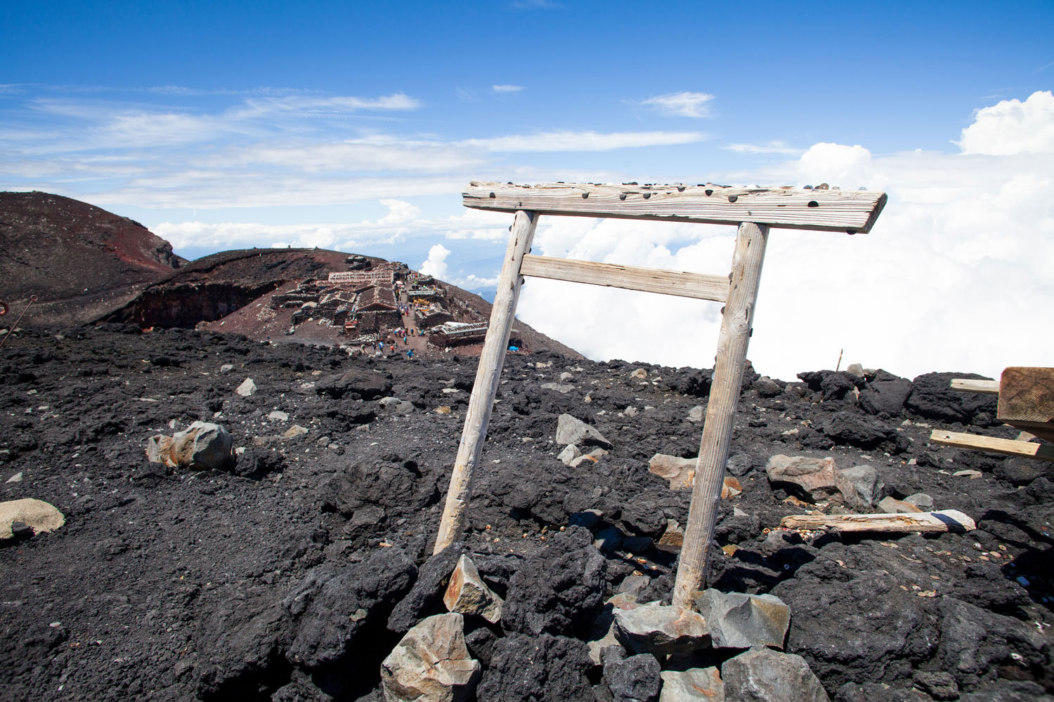
Fuji (富士山– Fujisan) is definitely the largest natural attraction and a primary icon of Japan. Hardly any Japanese is able to resist a trip there. The same applies to many foreign tourists, who often decide to climb the Fuji volcano while in Tokyo. It is Japan’s highest peak (3,776 m a.s.l.), with over 20 cultural sites and 4 trails. So whichever path you choose, the trek is bound to be exciting. A journey to Mount Fuji is not the most peaceful one, especially during high season (July-September). The place is very popular and besieged by tourists, who often need to walk in a single file, extremely slowly or stand in several hundred metre queues.
Three trails start from Shizuoka and one from Yamanashi. The last one is known as the Yoshida trail. The time of ascent is 5-7 hours, and of descent – about 3-5 hours. The trip starts at an altitude of 2,300 m. At the beginning, the trek is easy and you can see plenty of lakes along the way. The further up, the more beautiful the views and security chain ropes start to emerge. There are stations along the trail where you can take a breather, have something to eat or stay overnight. Many tourists sleep in a lodge and resume the ascent first thing in the morning to see the sunrise from the altitude of 3776 m.
The Kamikochi valley trail – Japanese Alps
Kamikochi (上 高地) is an over 15 km plateau in the Azusa River Valley. Following the trail, you may enjoy the spectacular view of the Japanese Alps, the numerous swamps, volcanic ponds or ravines running over the river. The path runs at an altitude of about 1,500 m and it is not too demanding. Furthermore, you will see the breath-taking Alpine views with local flora, with the greatest wealth of nature to be observed from May to October.
There are several two- and three-thousanders, such as Nishihotakadake, Okuhotakadake, Maehotakadake. If you find the path monotonous, you may leave the trail at a crossroads and choose a much more challenging ascent to the nearby summits. Adventurous tourists often choose a hike to the active volcano Yakedake (2,455 m a.s.l.).
88 Temples Trail on the Shikoku island
Shikoku is the smallest and the least populous island of Japan. The majority of the Japanese consider it an inka, i.a. a village. It is famous mostly for Shikoku Henro (四国遍路) – a special pilgrimage along a coastal mountain trail almost 1200 km long. There are 88 Buddhist temples along the way and it is impossible to visit all of them at once as such pilgrimage takes months and only few decide to complete it. Still you may find such daredevils on the trail. They are o-henro-san and you cannot miss them as they wear specific conical straw hats, purple shawls, white tunics and usually hold a wooden cane or rosary in their hands.
During the trek, you may admire not only giant hills and peaks but also the incredible ocean landscape and the white beaches along the Pacific coast. This is definitely a trail for those who want something more than altitude and climbing. And due to the pilgrimage character of the trails you may follow the spiritual journey of monk Kukai and meditate a little.
Trails in the Yakusugi Land park
While mentioning Yakusagi Land, one cannot leave out the fact that Yakushima – the island where the park is located – is on the UNESCO World Heritage List. It is considered as one of the most humid places in Japan. It owes all this to its natural assets and the thick ancient woods at its very heart. It is famous for a cedar forest with almost 2,000 tree species and some of the largest, one-thousand-year-old cedars.
There are 4 ways to travel the Yakusugi Land: a 30-, 40-, 80- or 150-minute trail. The paths are in no way challenging and one day is enough to tour the whole park. The longest route will take you to the Tachudake peak (1,457 m a.s.l.) with gigantic cedar trees, such as Kigensugi (紀元杉), and numerous macaques along the way.
Roof of Japan – Tateyama Kurobe Alpine Route
The Tateyama Kurobe Alpine Route is a trip for virtually everyone. You can travel by various means of transport, reaching both low peaks, such as Bijodaria (977 m a.s.l.) and high peaks, such as Tateyama (3,015 m a.s.l.). The route has trolleybuses, cable cars and bus transport. This way you can enjoy the incredible views of Alpine nature not only on foot but also from the air – by using the Tateyama Ropeway.
Major attractions on the route include the snow tunnel from the side of Kyoto, with walls up to 20 metres high. You can take a walk or ride along this incredible route from April to June near Muduro. Another site on the trail is Japan’s highest waterfall – Shōmyō (称名滝). Also make sure to mark the Kurobe Dam stop on your map. It is one of the most spectacular achievements of the Japanese, who overcame the difficulty of the mountain conditions to build a 183-metre tall dam that discharges 15 tonnes of water per second.
Both Europe and Japan have their own Alpine trails. But the name is all they have in common. The same applies to other Japanese mountain ranges, which differ from the Western ones in that that are often highly affected by human interference and trekkers may get stuck in traffic jams for many minutes. Still, this does not change that fact that Asian landscape is unbelievable, unique and has it own unparalleled character.


